It is incredible how you can learn new things about a familiar area with the right kind of map. Topographic maps give you a bird’s eye view of all the details of the land. Knowing where the mountains rise and the valleys fall is one benefit of studying the elevation of these maps, and making them for practical uses or simple beauty is a complex and intricate process.
What Is a Topographic Map?

There is nothing like seeing things from a new perspective. Maps share a lot of information about an area, and different maps display different details. Topographic maps give us a detailed and accurate aerial view of a specific area, showing the shape and elevation of the terrain in addition to waterways, roads, geographic landmarks, and manmade points of interest.
The beauty of these maps is seeing the three-dimensional aspects of the land on a two-dimensional map. When looking at elevation maps, it is easy to see the rise and fall of the hills and valleys. Mapmakers use contour lines on the map to showcase elevations as they grow and shrink throughout the area, making it easy to read.
Similar to topographic maps, bathymetric charts showcase the depths and shallows of lakes, rivers, seas, and oceans. By looking at these two maps together, you get a full view of how the land is shaped above and below the water.
3 Steps to Making Topographic Maps
Mapmaking, in general, is a complex and important field of work. When it comes to topography, there are several steps mapmakers take in order to create accurate charts:
- Obtaining aerial photos
- Conducting a field survey
- Verifying information
1. Using Aerial Photos for Reference

The first step in making topographic maps is to get aerial photos of the area to be mapped. A mapmaker will take a pair of aerial photos showing slightly different angles of the area and view them through an instrument called a stereoscope.
The stereoscope merges the two photos to produce a 3D view of the land. With these 3D maps seen through the stereoscope, the mapmaker can then draw the first draft of the chart depicting the area’s elevation.
2. Confirming Details with a Field Survey
While technology is increasingly improving the accuracy of topographic maps’ first drafts, a field survey of the area is an important step to ensuring the map is 100% correct. One essential element of the field test is establishing control points. There are two primary control points needed to create accurate 3D maps:
- Horizontal control points establish latitude and longitude
- Vertical control points identify the elevation of specific points
The vertical control points are essential for establishing the topographic map’s contour lines and ensuring the accuracy of the information provided on the map. The horizontal points allow for exact locations.
3. Verifying the Map’s Accuracy

Because topographic maps show more than just the land, mapmakers must verify all information included, such as landmarks, roads, and other points of interest. For example, a detailed topographic map of Naples, Florida, should include the grid of roads that runs through the city as well as iconic areas like Old Naples and Park Shore. Once the map has been verified, it is ready to be distributed for use.
Who Uses Topographic Maps?
Maps showing the intricacies of an area’s elevation are helpful for many kinds of people. Some common uses for these maps include:
- Soil conservation
- Emergency response planning
- Commercial and residential planning
- Military strategy
- Outdoor activities like hiking, fishing, and camping
Once you realize the wealth of information displayed, it is easy to find yourself using a topographic map in a variety of applications. Whether you are in a profession that utilizes these maps, you enjoy exploring the world around you, or you find the rises and falls of the land beautiful, these stunning maps may make their way into your life.
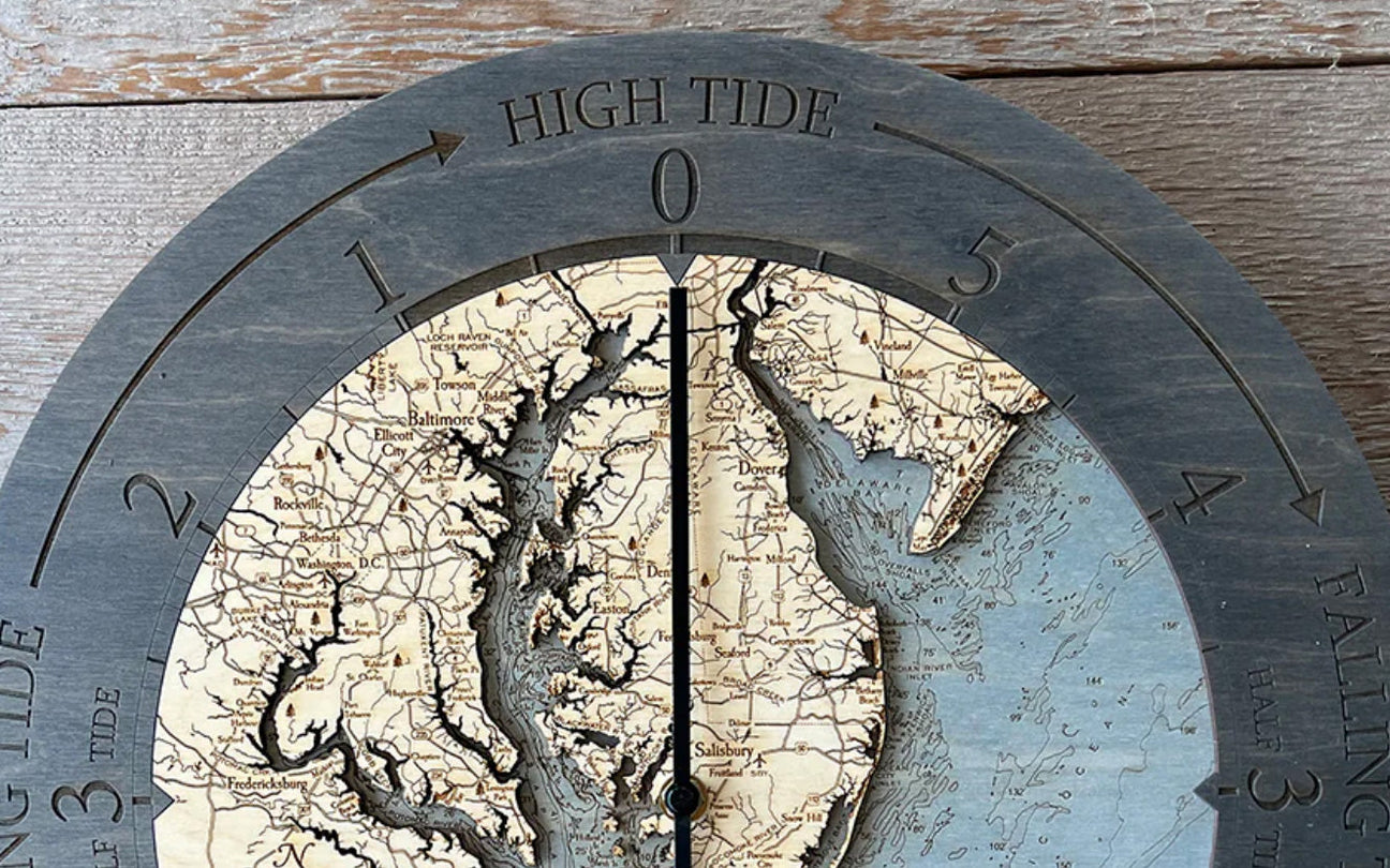
Topographic Maps as Decorative 3D Maps

Because topographic maps are fascinating to look at, they are often turned into decorative pieces for the home. Maps are already popular décor items, and by showcasing your favorite spot or the location of a treasured memory, these decorations can beautify your space while reminding you of an important place.
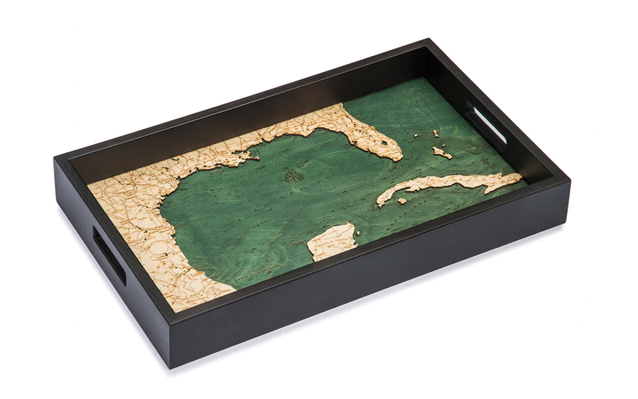
Decorative 3D maps come in many different formats. Whether you want to hang one on the wall or showcase it on a shelf, you can find a wood chart that meets your needs. With everything from serving trays to wall clocks, there is a way to display your favorite elevation chart.
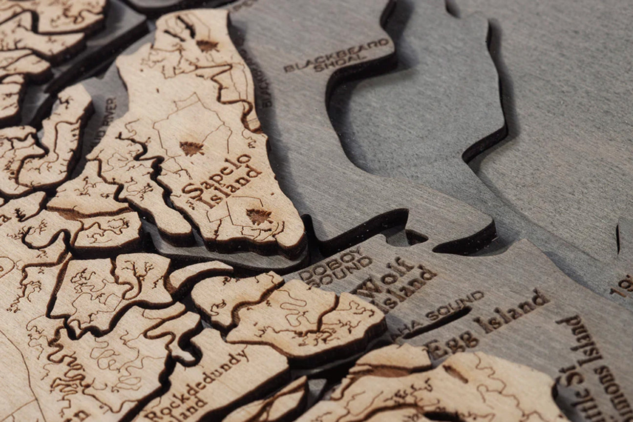
How Decorative 3D Maps Are Made
While the premise of these specialty maps is to show elevation with contour lines, it is easy to see how elevation charts are used to create artistic 3D maps. By stacking thin layers of high-quality birch wood, artists mimic either the topography or bathymetry of an area, showcasing the highs and lows of the land.
Some 3D maps physically mimic the topography charts, while others simply etch the details into the material. Cork maps, for example, only have two layers of material but still display the heights and depths expected from one of these intricate maps.
Topographic Maps of Favorite Places

You may be interested in seeing a sentimental spot from an aerial viewpoint with an elevation map, and looking at these maps can provide a new perspective of a treasured place. Commemorating your travels with a 3D map is one way to decorate in a tasteful and attractive way.
The 3D maps showcasing the Gulf of Mexico topography are prime examples of how stunning it is to see your favorite vacation spot in a new way. With the new vantage point, you can see your favorite beach or lake from a fresh perspective. Use a decorative map to remind you of a special spot or display the map in your vacation home to give guests a unique viewpoint of the area.
The making of topographic maps is an art in and of itself. From viewing aerial photos properly to verifying the information before putting contour lines and landmarks on paper, elevation charts are the perfect marriage of art and science. These measurements are made even more magnificent when displayed in decorative 3D maps, giving a bird’s eye view in a beautiful way.