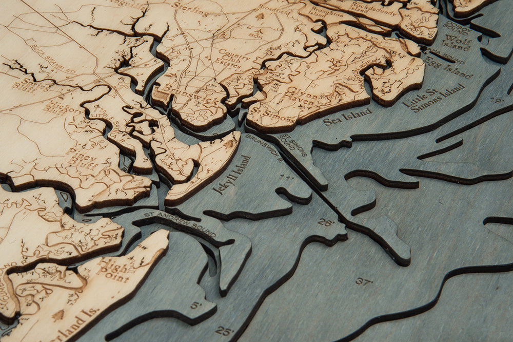
Georgia Coast 3-D Nautical Wood Chart, Large, 24.5" x 31"
Georgia Coast 3-D Nautical Wood Chart, Large, 24.5" x 31"
Free shipping to the continental U.S.
Couldn't load pickup availability

- Dimensions
- 24.5″ × 31″
- Material
- Baltic birch, hand-stained water
- Build
- Up to nine laser-cut birch layers
- Detail
- Carved bathymetric relief, laser-etched labels
- Source
- NOAA nautical survey data
A beautiful map of the Georgia Coast, Georgia. A 3-D nautical wood map featuring the Georgia Coast, The coast of Georgia is roughly 110 miles and includes 15 barrier islands, four of which (Jekyll, St. Simons, Sea and Tybee). In the coastal areas of Georgia and the southeast, nature provided early inhabitants with unique and... During World War II, Brunswick shipyards bustled with activity critical to America's war efforts
Creating our 3D wood maps is an intensive process. An artist laser-cuts thin layers of Baltic birch into the accurate shapes before gluing the sheets together to create the depth you see in each map. Each major point of interest and other details are etched into the wood before the custom wood frame is added before it’s finished with a protective, ultra-transparent sheet of durable acrylic.
Display this lake art in any room to create an instant conversation piece.
Points of Interest on Georgia Coast Map: Cumberland Island, Sapelo Island, Ossabaw Island, Savannah, Fort Stewart Hinesville, Kingsland, Jekyll Island
- Made of high-quality birch
- Up to 9 laser-cut layers of depth
- Engraved names and locations
- Acrylic glass protection
- Solid wood frame made to fit
- Arrives ready to hang
- Dark Brown Frame, Greenish Blue Water
- Rustic Grey Frame, Greyish Blue Water
- White Frame, Greyish Blue Water