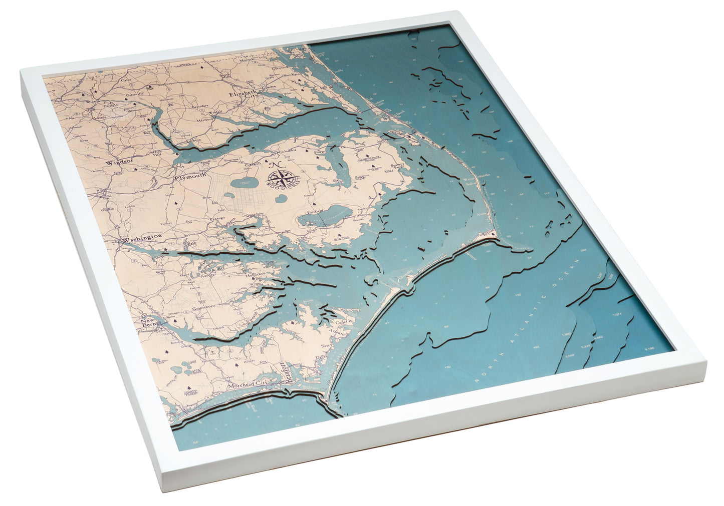
Outer Banks, North Carolina UV Nautical Wood Chart, Large, 24.5" x 31"
Outer Banks, North Carolina UV Nautical Wood Chart, Large, 24.5" x 31"
Free shipping to the continental U.S.
Couldn't load pickup availability
- Dimensions
- 24.5″ × 31″
- Finish
- UV-printed colour that darkens with depth
- Build
- Five birch layers, no acrylic cover
- Source
- NOAA bathymetric survey data
Outer Banks, North Carolina, is more than the birthplace of flight—it’s the backdrop for sensational beach vacations. OBX is a barrier island off the coast of North Carolina, connected to the mainland by the Wright Brothers Bridge, beautifully featured on this 3D wood map. Whether you crave pristine beaches, fresh seafood, or local history, the Outer Banks delivers it all.
Our Outer Banks 3D wood map captures the unique beauty of this iconic stretch of coastline with stunning precision. High-quality Baltic Birch is laser-cut into layers that reveal the depth and contour of the surrounding waters. Each layer is hand-stained so the water grows darker as the depth increases, creating a striking gradient that brings the contours of the lakes to life. These layers are carefully bound and hand-stained to highlight the shifting tones of the ocean and the land’s natural charm. Finally, ultra-high resolution UV printing brings the region’s points of interest and intricate details to life, resulting in a vibrant, ready-to-hang work of nautical art.
Keep a piece of the Outer Banks close at hand with this beautifully crafted map that evokes the spirit of the Carolina coast.
Points of Interest on the Outer Banks, North Carolina, Wood Map:
Cape Hatteras, Hatteras Island, Bodie Island, Roanoke Island, Fort Raleigh, Kitty Hawk Bay, and Kitty Hawk Pier
Outer Banks Wood Map Details:
- Made of High-Grade Birch
- Hand-stained water layers that darken with depth
- Up to 5 laser-cut layers of depth
- Ultra-high resolution UV printed details
- Solid wood frame made to fit
Frame Styles:
- White Frame, Teal Water
- Rustic Grey Frame, Calm Blue Water