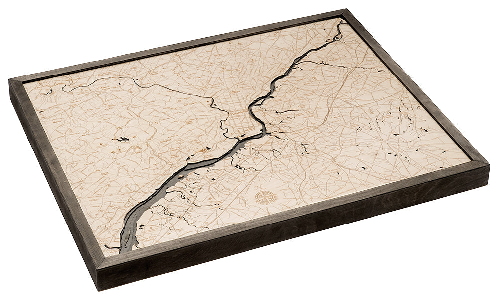
Philadelphia 3-D Nautical Wood Chart, Large, 24.5" x 31"
Philadelphia 3-D Nautical Wood Chart, Large, 24.5" x 31"
Free shipping to the continental U.S.
Couldn't load pickup availability
- Dimensions
- 24.5″ × 31″
- Material
- Baltic birch, hand-stained water
- Build
- Up to nine laser-cut birch layers
- Detail
- Carved bathymetric relief, laser-etched labels
- Source
- NOAA nautical survey data
Home to the Liberty Bell, the Philly Cheesesteak, and the iconic steps from the movie, Rocky, Philadelphia has been setting historic milestones since it became the capital of the Pennsylvania Colony in 1682. The topography of the city is etched into this wood chart, highlighting the landmarks, and detailing the Delaware River as it wanders through the city, separating Philly from New Jersey. Within the city of Philadelphia there are 67 National Historic Landmarks and the World Heritage Site of Independence Hall.
The 3D wood map of Philadelphia is the perfect addition to any study, family room, or home office. The points of interest are intricately detailed in high-quality Birch, creating a roadmap of the perfect vacation. Your wood chart arrives in a custom wood frame and is ready to hang.
Abington, Bristol, Burlington, Cherry Hill, Chester, Claymont, Darby, Malvern, Moorestown, Norristown, Phoenixville, Plymouth Meeting, and Wayne Philadelphia Wood Chart Details:
- Made of high-quality birch
- Up to 9 laser-cut layers of depth
- Engraved names and locations
- Acrylic glass protection
- Solid wood frame made to fit
- Arrives ready to hang
Frame Styles:
- Classic, Dark Brown Wood, Greenish-Blue Water Color
- Rustic Grey Frame, Greenish-Blue Water Color