Considerable, immense, tremendous — all words that can be substituted for “great,” and each synonym would still describe the Great Lakes perfectly. The five lakes that grace the northern U.S. border are a wonder to see. Great Lakes maps can serve as a beautiful representation of these immense bodies of water, but very little compares to actually visiting the lakes yourself.
A road trip around the Great Lakes could take 5-10 days, so get your Great Lakes maps out and start planning for a trip of a lifetime. Remember to take photos and find souvenirs along the way, including stunning wood lake maps that will remind you of your vacation for years to come.
What’s so Great About the Great Lakes?
There is a lot that’s great about the Great Lakes. Whether you are planning a trip or you have fond memories of vacationing on the United States’ Third Coast, gazing at Great Lakes maps can be inspiring and nostalgic.
The Great Lakes are the largest freshwater lakes on Earth and are interconnected, linking the Atlantic Ocean to the Saint Lawrence River. They have been around for over 20,000 years, and millions visit the region each year for some rest, relaxation, and recreation.
Great Lakes maps include all 5 lakes:
- Lake Michigan
- Lake Superior
- Lake Huron
- Lake Erie
- Lake Ontario
In addition to the beautiful shoreline are 35,000 islands across the Great Lakes. Because of travel across the lakes over centuries, the shores are peppered with lighthouses, and the lake beds are the final resting places for several shipwrecks.
An In-Depth Look at Each Great Lake
Great Lakes maps tell the stories of history, exploration, and modern-day fun. Learn about what makes each lake in this system special and which points a wood map highlights so you can pick the lake art that’s right for you.
Lake Michigan
Lake Michigan is the favorite lake for many people. There are many fun facts a Michigander might want to tell you about this prized pool. For example, Lake Michigan only has islands in its northern region, which is easy to see on Lake Michigan maps.
Lake Michigan is the most visited of the Great Lakes, with major cities like Chicago and Milwaukee along the shore. Aside from the more populated areas, natural beauty like the Sleeping Bear Dunes National Lakeshore beckon travelers to see the wonders near the water.
What Lake Michigan Maps Show Us
Lake Michigan maps highlight many key places that bring pride and nostalgia to residents and travelers, including:
- Beaver Island
- Egg Harbor
- Mackinaw City
- Whitefish Bay
Comparing Lake Michigan maps to other Great Lakes shows one crucial distinction: Lake Michigan is the only Great Lake entirely within the United States. Because of this, it is the largest lake measured by area within a single country. Wisconsin, Illinois, Indiana, and Michigan all share Lake Michigan.
Lake Michigan maps also show why the Hopewell Native Americans dubbed this particular body of water “Michi-game,” which is the Ojibwe way of saying “great water.” We certainly believe it is great!
Lake Superior
It’s easy to see how Lake Superior lives up to its name. Lake Superior is the biggest lake in the world by surface area and has been nicknamed “the Freshwater Sea.” This large reservoir holds almost 3,000 cubic miles of water, which could fill all the other Great Lakes plus an additional three Lake Eries.
Lake Superior sits at the northernmost point of Great Lakes maps, with borders along Minnesota, Wisconsin, Michigan’s upper peninsula, and Canada. Water flows into Lake Superior from 200 rivers and then discharges into Lake Huron through the St. Marys River.
Lake Superior Wood Map Highlights
With a depth of over 1,330 feet, wood lake maps are perfect to showcase Lake Superior’s unique details. Aside from the wonders of the large lake itself, maps showcase other points of interest like Isle Royale and Superior National Forest.
Lake Huron
Look at your Lake Michigan maps and travel east to see Lake Huron on the other side of the Straits of Mackinaw. This second-largest of the Great Lakes, Lake Huron borders the thumb portion of the Michigan “mitten” to the south and west and Canada to the north and east.
Lake Huron’s specific placement makes it the perfect place to catch a startling sunrise at the beginning of the day. With the eastern shoreline on the lower peninsula, this particular pool has a reputation for being the place to wake up early and enjoy a colorful beginning to your day.
Whether the sunrises, the beaches, or the turquoise waters draw you to visit Lake Huron, you won’t want to forget your trip anytime soon. Pair a few of your favorite sunrise photographs with wood maps of the lake for a beautiful display that will bring you back to that lake life in your mind.
Lake Erie
Lake Erie may be the shallowest of all the Great Lakes, but that doesn’t mean its intrigue is only surface level. In fact, Erie’s shallow and warm waters have created an environment that supports the most biologically productive and diverse ecosystem of all the Great Lakes.
Just below Lake Huron on the Great Lakes maps, Lake Erie receives most of its water from the Detroit River. Then, the primary natural outflow of the lake is the Niagara River, which produces hydroelectric power near Niagara Falls.
Notable Lake Erie Map Locales
Wood lake maps of Lake Erie show Canada to the north of the basin, which sits on the border between Canada and the United States. On the U.S. side, the lake is bordered by Michigan, Ohio, Pennsylvania, and New York. Other notable points of interest highlighted around Lake Erie include Lake St. Clair, Detroit, and Presque Isle.
Lake Ontario
When looking at Great Lakes maps, Lake Ontario stands out for several reasons. First, Lake Ontario is the smallest of all the Great Lakes. It is also the only one of the Great Lakes that does not border Michigan. Instead, the borders of this lake include the Canadian province of Ontario to the north, west, and southwest, and New York to the east and south.
Even though Lake Ontario is the smallest of the Great Lakes, it is still the 14th-largest lake in the world by square miles. This is partially due to its depth, reaching 800 feet in some areas.
Lake Ontario Wood Map Destinations
Lake Ontario has 712 miles of shoreline with more than 100 beaches and multiple islands. The Niagara River is the main feeder for the lake. Great Lakes maps of Lake Ontario also show Niagara Falls, Amherst Island, and the St. Lawrence River.
Why Wood Lake Maps?
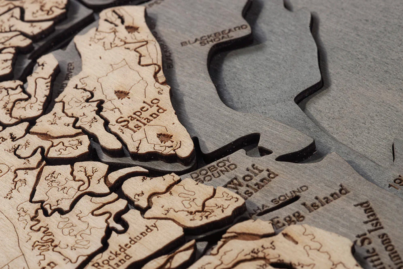
There are countless souvenirs and memorabilia to commemorate your time at the Great Lakes, but wood lake maps are a unique and beautiful tribute to these majestic bodies of water. Great Lakes maps are especially striking because of the unique shape each lake brings to the map. The varying depths are emphasized on the wood, and the details are easy to pinpoint. Whether you zero in on a particular lake, like any of the Lake Michigan maps, or you choose a map of all five Great Lakes, wood lake maps are a unique way to showcase the area.
How are Wood Maps Made?
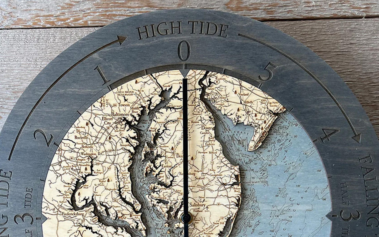
Wood lake maps are made by combining precise measurements with artistic skill. Using bathymetric measurements of the lake’s depths, an artist will cut out high-quality birch wood to emphasize the lake bed. Then, with wood stain and laser etching, the map is constructed with details on land and underwater noted.
5 Types of Wood Lake Maps
It is no surprise that Great Lakes maps are so beautiful, but it is excellent to know there are several ways to use or display your wood lake maps. Each kind of wood lake map uses the same precise measurements and artistic style, but they serve different functions throughout the home.
You have several options for wood lake maps depending on your needs and where you want to display your Great Lakes maps. Take a look around your space and spend time looking through the different wood lake maps. Feel free to be creative — your Great Lakes maps don’t have to be simply decorative, but they can also be useful.
1. Nautical Wood Charts
Displaying your wood lake maps on the wall is a tried-and-true way to commemorate your favorite vacation destination. There are large and small Great Lakes maps, and there are options for individual lakes as well.
Consider displaying your Great Lakes maps together. Choose a wood chart of all the Great Lakes and then pair it with one of the wood lake maps of your favorite lake.
Each nautical wood chart comes with a solid wood frame that is made to fit and acrylic glass protection and arrives ready to hang.
2. Wooden Wall Clocks
Wood lake maps can be both practical and beautiful at the same time. A wood clock is the perfect way to meet a need in your home while paying homage to your favorite Great Lakes maps.
Lake Michigan maps make stunning wood clocks. Hang your wood lake maps timepiece with pride to enhance your décor. When you glance at the time, you also get a stunning glimpse of your favorite Great Lake map.
Each Wood Chart clock has a 12-inch diameter and is powered by a single AA battery. Clocks come ready to hang so you can admire them starting from Day 1.
3. Wood Cribbage Boards
You may or may not be familiar with the timeless card game of cribbage, but you will quickly become obsessed as you dive into the gameplay. Beautiful wood lake maps cribbage boards come with almost everything you need to start playing:
- Skunks
- Pegs
- Hidden storage compartment
Just grab a deck of cards and a friend or two to see who can earn enough points to claim victory.
The Lake Michigan maps cribbage board is one perfect example of how pretty these gameboards can be. Look out onto the chart of the lake while playing cribbage. You could even use the board to spark conversation that might break your opponent’s concertation. Then, when you are done with your game, hang the board on the wall to provide an aesthetic focal point for your room.
4. Lake Art Serving Trays
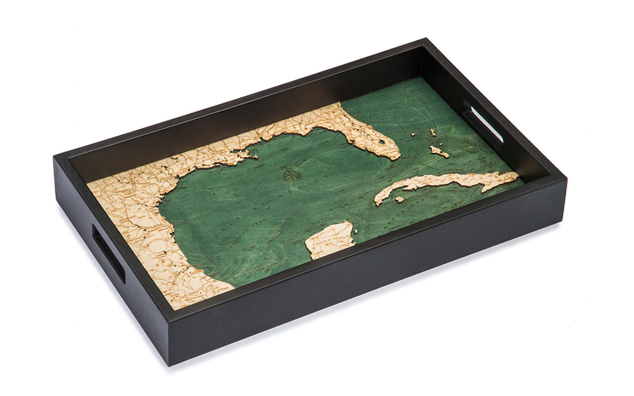
Imagine serving your favorite snacks or breakfast in bed on one of the beautiful Great Lakes maps serving trays. Each tray captures the wood lake maps behind a layer of acrylic glass to protect the birch wood while keeping its usefulness. Handles built into the sides make moving from room to room easy.
Of course, you can get creative with a serving tray. Display your Great Lakes maps serving tray on your coffee table as a centerpiece, perhaps decorated with other souvenirs from your lake days. Or use it as a portable bar as you bring drinks out to the dock at your lake house. The possibilities are endless when using a serving tray to display your favorite Great Lakes maps.
5. Cork Map Lake Art
Looking for something smaller to bring to the office or accent an already-decorated area? Consider one of several cork Great Lakes maps. Each of these wood lake maps starts with a piece of birch wood that is laser cut into the shape of the lake’s shoreline. That wood is then glued to a piece of cork, and the cork face is etched with the details that would be on any other wood chart.
At 8x10 inches, cork maps are a great way to add lake art to your already-existing décor. Add one to a bookshelf or on the counter to remind you of your favorite lake. Cork wood lake maps also make wonderful gifts for the lake-lover in your life.
Remembering Your Time on The Lakes
Commemorating a special trip with your loved one or family vacations to the lake is worth an investment. You will want more than your memories as the years go on, and wood lake maps are a great way to keep those reminders visible daily.
Whether you grew up in Michigan and want to share your state pride or spent your summers at the Great Lakes while you were growing up, it is well worth it to display your favorite spots. Hang your wood lake maps with delight and remember the feeling of the breeze coming off the lake as you watch the sunrise over the water.


